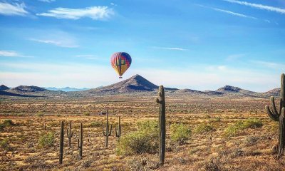
Arizona
Catch The Wave in Northern Arizona
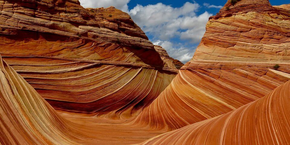
The Wave is a magnificent natural landmark made of Navajo Sandstone located in Northern Arizona. It is a huge draw for many hikers and explorers looking for the most amazing locations and adventures. You probably have seen images of The Wave set as the wallpaper on many computer screens. But what is The Wave? And Where is it? Let’s learn more about The Wave in Arizona, shall we?
Where is The Wave in Arizona?
The Wave is located in Northeastern Arizona near the Utah border. It is a part of the slopes of the Coyote Buttes in the Paria Canyon-Vermilion Cliffs Wilderness of the Colorado Plateau. Yeah, that sure is a mouthful. But this area of the world is truly miraculous. There is so much to see and do, it would take a lifetime to discover everything it has to offer.
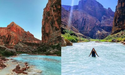
Nearby you’ll find famous natural Arizona landmarks such as Antelope Canyon, Horseshoe Bend, Canyon de Chelly, and of course, the Grand Canyon. All of these locations would provide a dream vacation for lovers of natural beauty and unique geology. Though, you’ll have to be in decent shape to traverse this high desert terrain. So start your diet today!
What is The Wave in Arizona?
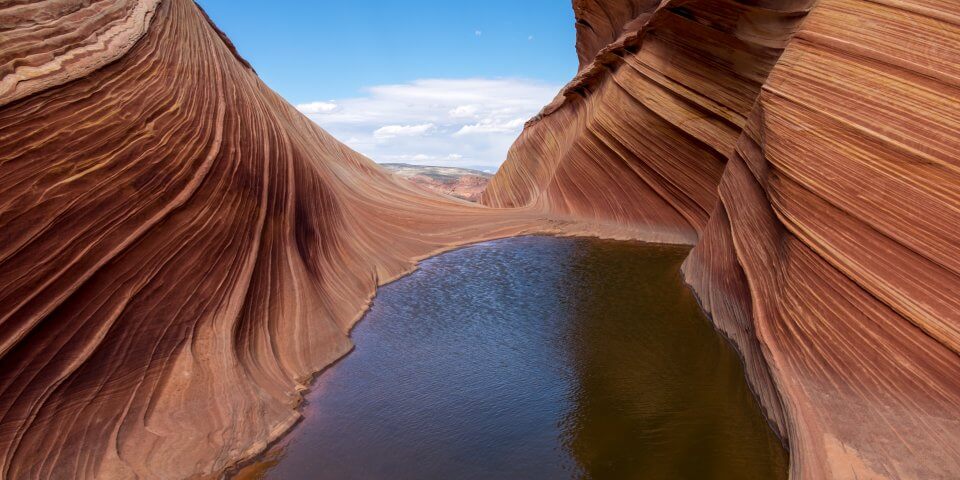
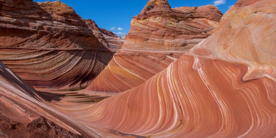
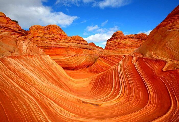
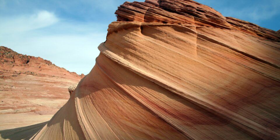
The Wave is a series of intersecting Navajo Limestone formations that give it the series of lines that make the shape of a massive wave. It was formed back in the Jurassic period when the area received a lot more precipitation and rainfall.
The Wave consists of two major sandstone troughs. One is 62 feet wide and 118 feet long. While the other is much smaller at 7 feet wide and 52 feet long.
The fine layers of sandstone ripple through the troughs creating this wave-like dance that gives it its unique look. The layers also criss-cross in section, which adds to the wavy look. This is very similar to many formations in nearby Antelope Canyon.
How Do You Get a Permit to Hike and Visit the Wave?
Well, this is the tricky part. Due to the enormous popularity of The Wave (thanks to Microsoft and their popular Windows 7 Wallpaper), it isn’t just as easy as driving up there and exploring willy-nilly. Instead, you’ll have to enter a lottery system that is held daily. On top of that, this lottery only issues 10 permits per day!
Since the lottery is controlled by the Bureau of Land Management, you’ll have to apply in advance here. It’s a good idea to apply several months in advance so you can have a better chance of getting a permit. You can choose your desired date throughout the year. Therefore, it’s wise to plan your visit to the Coyote Buttes around a few days.
How Many Trails Does The Wave Have?
There are only 4 different access trails to the Paria Canyon and The Wave. Although, they’re not that easy to find because it’s a protected area and no one wants a bunch of signs stuck in the ground ruining the serene natural scenery. The 4 trailheads are as follows:
- White House Trailhead (most commonly used and considered the main entrance)
- Buckskin Gulch Trailhead (more advanced)
- Wire Pass Trailhead (more advanced)
- Lee’s Ferry Trailhead (located at the Southern part of the Paria Canyon and is most commonly used as the exit by hikers)
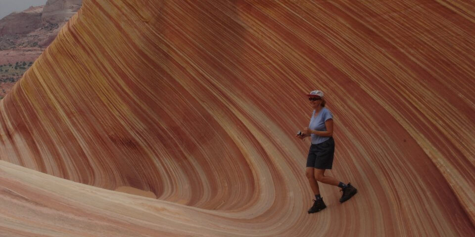
The shortest of the hikes is the Wire Pass trailhead, which is only about 3-miles long (6 miles round-trip). This hike is also probably the most difficult for most because it is primarily a hike across the open desert while climbing up 350 feet. A hike like this in the summer months can be treacherous with temperatures reaching 100-degrees Fahrenheit.
How To Navigate The Wave
Navigating your way around The Wave can be tricky considering there are no guideposts and the landscape can appear confusing due to the cliffs. However, you need not worry because the Bureau of Land Management offers a guide book once you get your permit.
The guide book is designed to be used with a compass (so get your compass skills in order), and GPS. It is strongly advised to study the guide book before venturing out into The Wave because even it can be confusing.
There are 6 checkpoints for hikers. Each checkpoint is color-coded and features pictures of the terrain ahead of them. It also includes the exact longitude, latitude, azimuth, UTM, as well as northing, and easting.
After One Visit to The Wave in Arizona, You’ll Be Changed Forever
Hiking The Wave in Arizona will not only challenge your hiking abilities, but it will provide you with a breathtakingly beautiful landscape that could only be found in nature and dreams. Many travelers who have visited The Wave in the past have been so captivated that they felt compelled to paint it in an attempt to keep it with them forever. We feel that if you come out and visit Northern Arizona, you’ll too catch The Wave!

Here are 23 Slang Terms You’ll Only Understand if you’re from Texas

Here are 19 Slang Terms You’ll Only Understand if you’re from Alaska

Here are 28 Slang Terms You’ll Only Understand if you’re from Arizona

12 Reasons Why Californians are moving to Arizona

10 Reasons Why You Should Never Ever Consider Moving to Louisiana

Check Out This Salt Cave in New Mexico That is Said to Melt All Your Stresses Away

10 Photos Only People from Arizona Will Understand

Luke Days Airshow is Back This Weekend! Here’s What You Should Know

Here are the 10 Best Mexican Restaurants in New Mexico – Awesome Margaritas Included