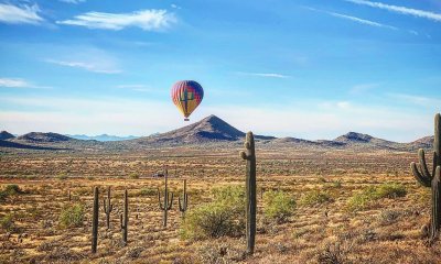
Arizona
Go on One of the Most Epic Drives in All of Arizona for an Adventure Like No Other
“The long and winding road,” is probably how the Beatles would have put it. The Grand Canyon State, in its massive expanse, has a network of longwinded roads. Each one leads to a beautiful destination and a new adventure. Route 191, more popularly known as the Coronado Trail Scenic Byway, offers Arizona’s windiest, most scenic, and most exciting drives ever. Why is that? Go on a virtual adventure with us and keep reading.
Formerly Known as the Devil’s Highway, Coronado Trail Scenic Byway Nickname is Well-Earned
Source: Instagram
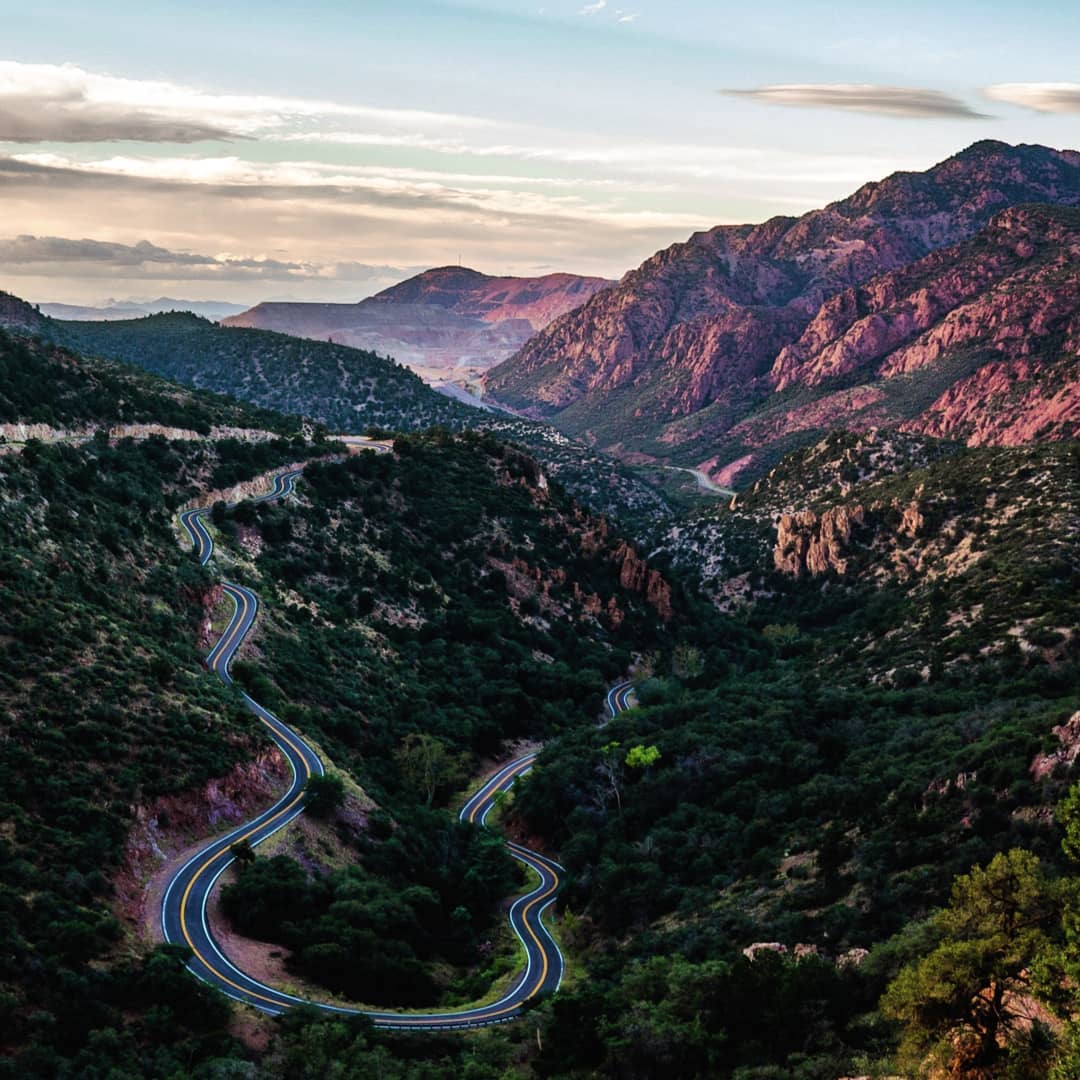
No matter where you go, the journey matters just as much as the destination. That is why you should choose a beautiful highway if you plan to have a “good time” on the road. Arizona is home to the “Devil’s Highway” or the Coronado Trail Scenic Byway. Right now, it is simply called U.S. Route 191. We know exactly what you are thinking. How come it’s called the Devil’s Highway? Well, the number does give away the whole devil shenanigan, but there’s more to it in reality. Before being called Route 191, Route 666 was its former title. Thus, the devil nickname.
Source: Instagram
But we think there is another reason for all that. This highway is not a straight or elementary path. If you don’t like stepping out of your comfort zone in driving, then you’ll find this route very punishing as ever. The road consists of consecutive twists and turns that seem to be going on forever. Our word of advice: take precaution and prepare.
Source: Instagram
Make sure the driver who will be joining you on your trip can handle long drives and curvy roads. Check your car, brakes, oil, engine, and all. Aside from that, make sure to fuel-up and pack supplies, as there are no fuel stations or convenience stores along and within the area of the route. The last and most important step of all preparations is to ready an epic playlist of driving soundtracks, bring a good camera, and bring your best mates or your loved one!
When you are going upwards, it will take you around 4 hours to finish the drive. The average speed is 25 mph and much of the time you’re going around 10 mph. But since you are driving along a curvy mountain road, you won’t mind the “slow speed.”
As One of the Curviest Roads in the Country, Coronado Trail Scenic Byway is Definitely One Challenging Drive!
Source: Instagram
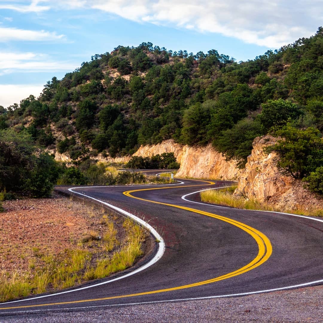
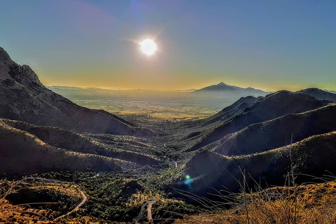
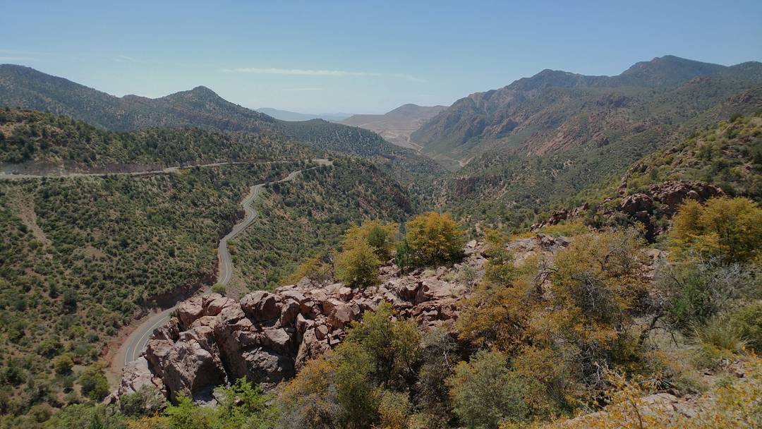
The piece of cautionary advice given is not to be taken lightly. There’s a reason as to why this drive is so engaging and intriguing. You see, the Coronado Trail Scenic Byway is curvy, and we need to stress that more, it’s hella curvy. Being dubbed the windiest road in Arizona, it has more than a whopping 460 (yeah, you read that right) curves in total, the sharp ones included. Add that to the fact that the route is 120 miles long, and you’re staring at a pretty long, scary, but exciting road trip!
Source: Instagram
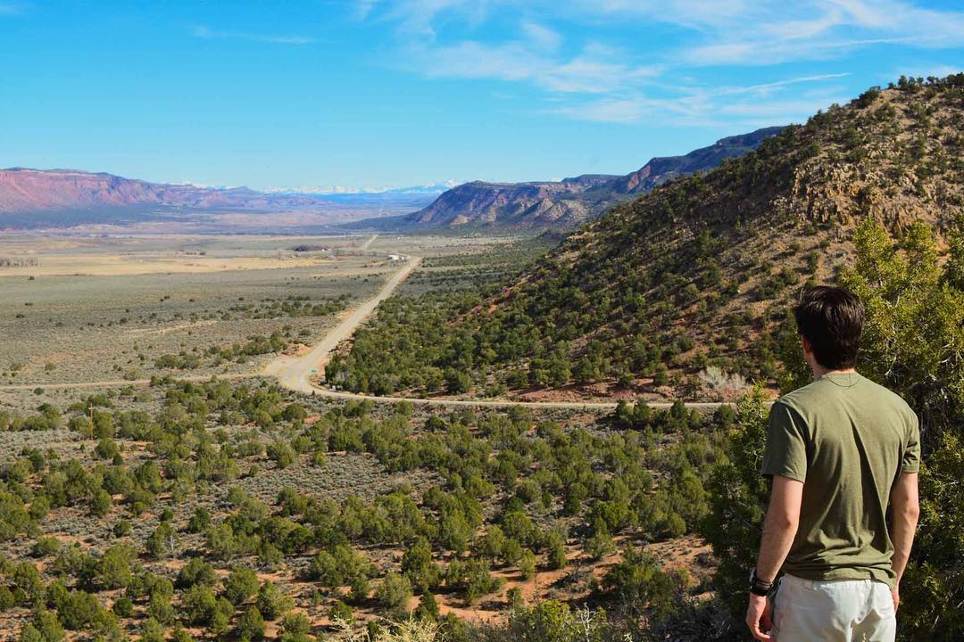
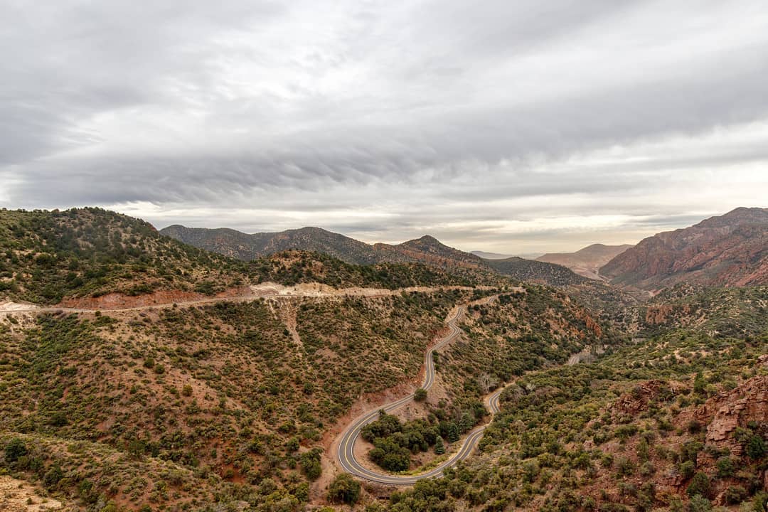
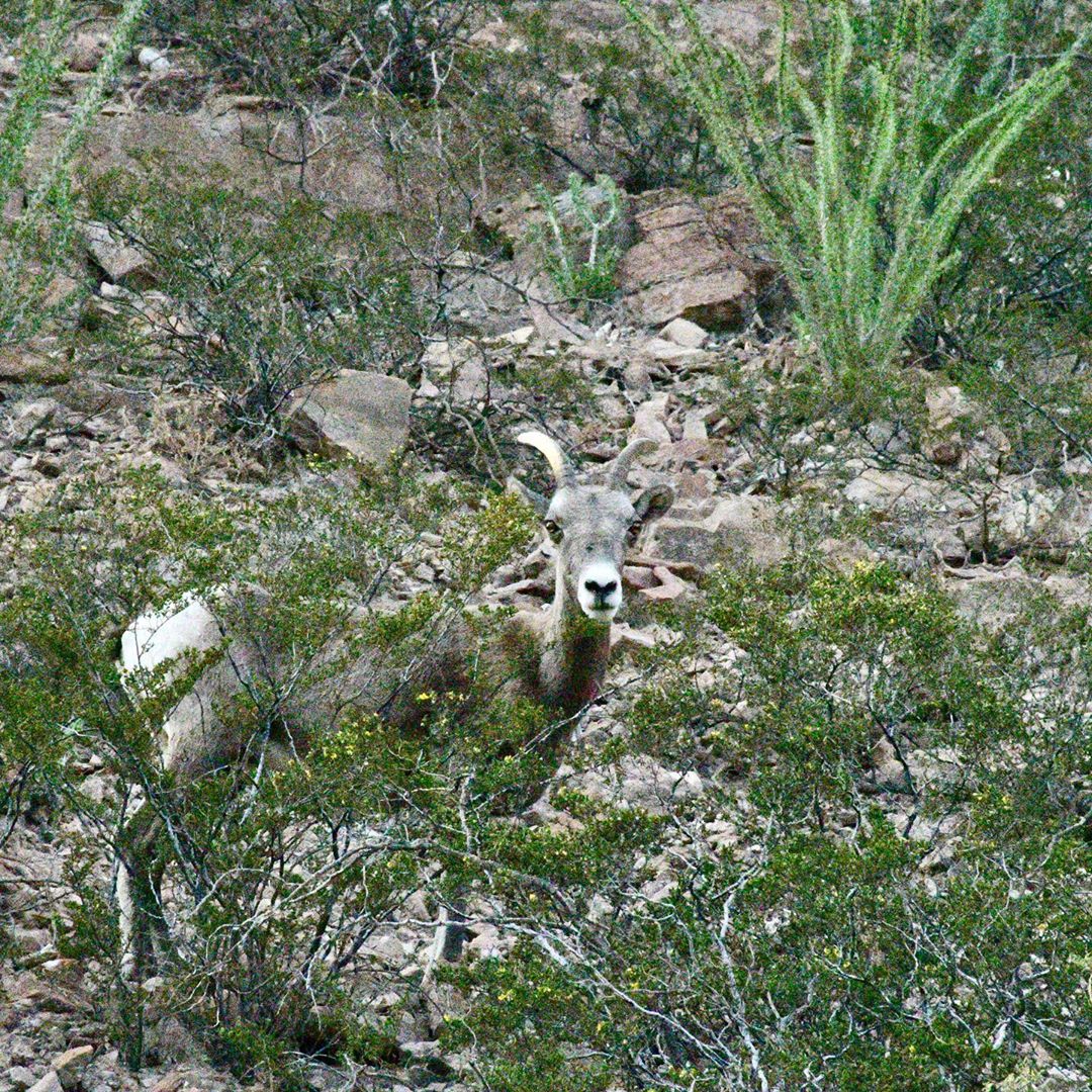
It winds down from the twin cities of Eagar and Springerville in the north to the twin cities of Clifton and Morenci in the south. You will even pass by a beautiful route used by the Spanish explorer Francisco Vasquez de Coronado. From there, the road will take you through the Sipe White Mountain Wildlife Area where you will be given a chance to spot animals like ospreys, elks, and golden eagles.
Fall In Love With the View
You will also reach the forests near Alpine, a swiss-like area that is also too dreamy for words. Before you reach Alpine, you might be able to catch a glimpse of the worst evidence of the Wallow Fire, which torched more than 550,000 acres of gorgeous forest, including most of Escudilla Mountain in 2011. The carnage might make you feel sad, but that should just leave you with the lesson of exploring the outdoors responsibly!
Source: Instagram
Overall, the drive along Coronado Trail Scenic Byway is memorable and will probably be one of your most favorite rides ever! The lush grasses and young aspens that are growing will make you feel hopeful, and happy. Stop for fuel, or just take a break when you reach Hannagan Meadow because it is literally the last stop for fuel. The place is charming, and you might be tempted to stay the night at Hannagan Meadow Lodge. You won’t find many hotels, motels, RV parks, or camping sites in the area because it is generally off-limits to commercial development.
Source: Instagram
Continue heading south and keep your eyes peeled for more wildlife viewing opportunities. The trees that surround the whole area will also delight you. Check out the tall and beautiful aspens, firs, oaks, maples, and more. Just think about how the area looks like during fall or winter. You will probably be in awe of its sheer beauty.
So Why Take This Road Trip?
Source: Instagram
We’ve already mentioned the substantial length and the absurd number of curves you’ll find in the Coronado Trail Scenic Byway. We’ve also noted the arduous preparations for the trip. “So Why this road trip?” seems to be the question.
You see, all of the facts are just precursors to ensure that you prepare for the road trip well. It makes it more likely that your experience of the route would be more eventful rather than deplorable.
There is this always exhilarating feeling of driving at night, windows down, playing music and jamming along with your friends or family under the bright starry sky. You feel the euphoria of everything else being irrelevant as you drive through the winding country road, constantly speeding past and curve through the zigzags.
Source: Instagram
All that as you marvel at the beauty of the natural scenery that is Arizona, transitioning from the luscious greenery to the dry and arid star-sprinkled landscape. Sounds much of a hook, right?
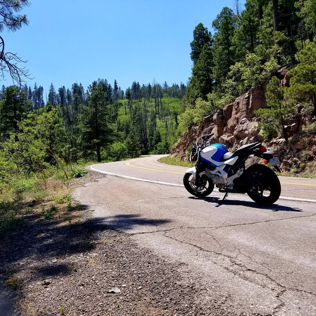
That’s the spirit of road trips after all, and this is the road trip that is Coronado Trail Scenic Byway. Don’t be surprised if you also see a group of bikers hitting the road with their Harleys. A lot of peers plan such a trip.
Details
Distance: 120 miles one way
Directions:
From Payson
1. Go east on State Route 260 for 87 miles to U.S. Route 60.
2. Turn left onto U.S. 60. Then, continue 49 miles to Springerville.
3. From Springerville, just go south on U.S. Route 191 for 120 miles to Clifton.
Note: There are no vehicle requirements when traveling along the Coronado Trail Scenic Byway. However, you should be prepared for the several sharp curves and steep drop-offs along the narrow road. Some parts of the highway do not have guardrails. You also need to slow down (10 mph) in dangerous spot for safety reasons.
Indeed, Coronado Trail Scenic Byway is a challenging road trip adventure enough to make you think twice. That’s why you should clear your doubts by going in headfirst and experiencing it yourself! It is an epic road trip of a lifetime!
If you are up for an even greater adventure, check out 6 Arizona Day Trips to Explore the Best the State Has to Offer. In addition, you will like the 7 Most Terrifying Drives You Can Take in All of Arizona.

Visit these Extraordinary Eco-Spaceships Found Only in New Mexico

15 Expressions You’ll Only Understand if You’re From Tennessee

18 Reasons Why North Carolina is the Most Overrated State

Here are 10 Things People from California Do That Seem Insane To Everyone Else

Here are 10 Things People from Louisiana Do That Seem Insane To Everyone Else

Check Out This Salt Cave in New Mexico That is Said to Melt All Your Stresses Away

10 Reasons Why You Should Never Ever Considering Moving to Arizona

10 Photos Only People from Arizona Will Understand

Here are the 10 Best Mexican Restaurants in New Mexico – Awesome Margaritas Included