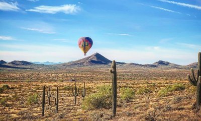
Arizona
6 Reasons Sunset Crater in Arizona is Cooler Than You Think
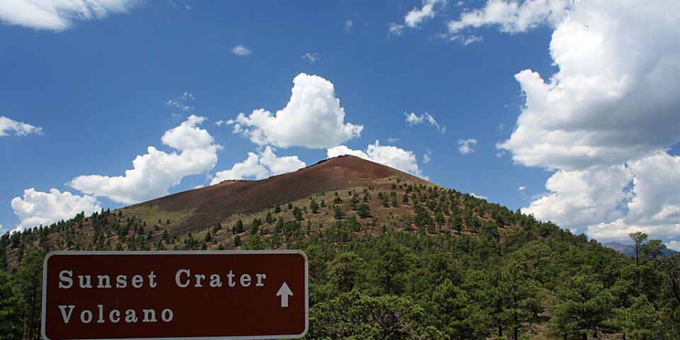
Sunset Crater is a crater made from a now dormant volcano just north of Flagstaff, Arizona. Check out these reasons why you should make a trip out to visit it.
1) Sunset Crater is Just One of Two Important Craters in the State
Sunset Crater is located about twelve miles north of Flagstaff, but farther southeast you’ll find Meteor Crater as well. Though people might mention these craters together since they are both found in the great state of Arizona, they were formed by completely different processes. Meteor Crater was formed when a chunk of nickel-iron weighing 300,000 tons careened into the earth, sending 175 million tons of rocks flying up into the air. Sunset Crater is not this type of crater. It actually lies at the top of a cinder cone.
2) How Was Sunset Crater Formed?
Unlike Meteor Crater, which formed suddenly and violently, Sunset Crater formed slowly and violently. A volcanic eruption started out slow, hinting to nearby settlers of the pending doom of the area. The ground shook periodically, trembling more and more as the days passed until, finally, the earth was split wide open by an eight-mile-long crevice. From this fissure leaked flame, ash, and steam. Not only did magma shoot 2,000 feet into the sky, but black smoke soon followed the fiery lava, obscuring the sun. Normally a volcanic eruption like this would last around eight months, but…
3) How Long Did the Sunset Crater Volcano Erupt For?
The volcano that created Sunset Crater erupted for over 100 years! Incredibly, this area was seized by geological violence for over a century. The air was filled with the noxious fumes of gases rising up from the cracks in the earth, and cooling lava fell, covering the ground in a layer of dark cinder. As more and more lava exploded into the air and found its way back to the surface, the settling cinder began to form a cone that continued to grow as the years passed. Billions of tons of material were forced to the surface of the planet during these violent eruptions. When it was all said and done, as much as fifteen feet of ashes covered an area nearly nine hundred square miles. Not only that, but actual lava itself was 100 feet thick in places, as far away from the eruption site as six miles.
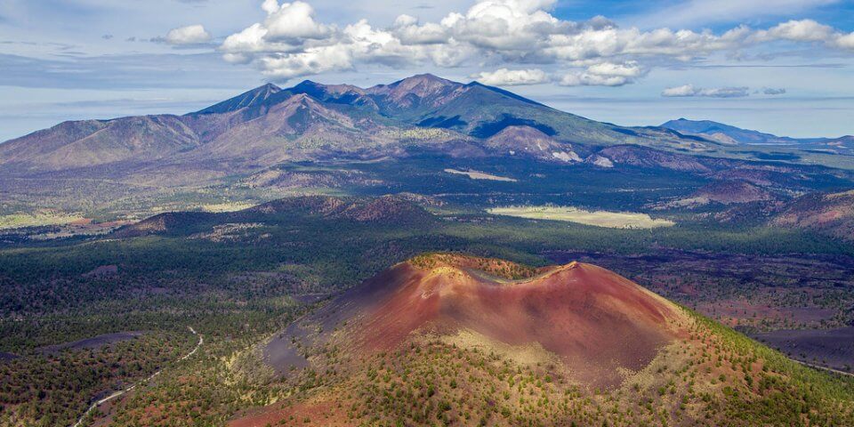
4) Sunset Crater’s Name Certainly Doesn’t Seem That Fitting…
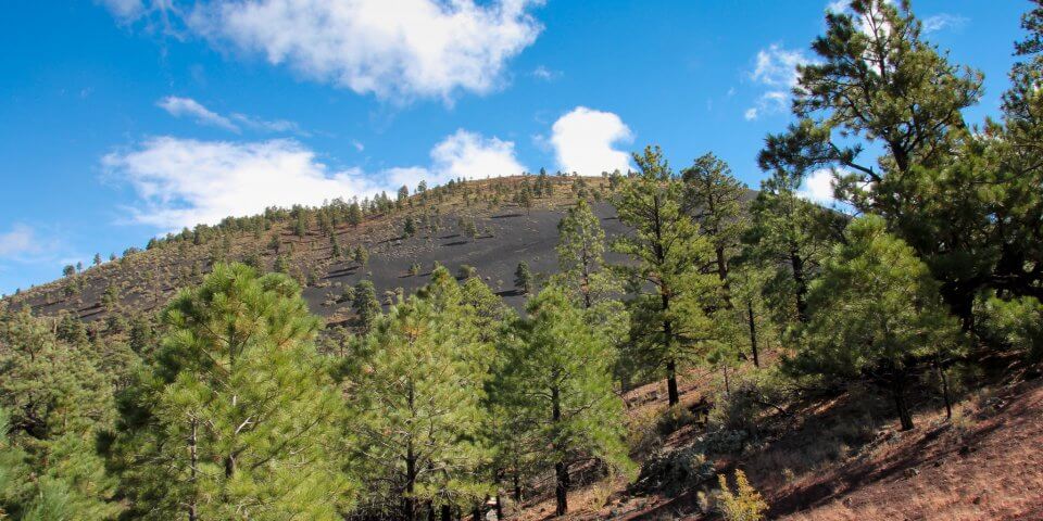
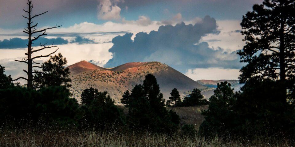
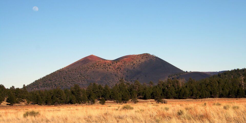
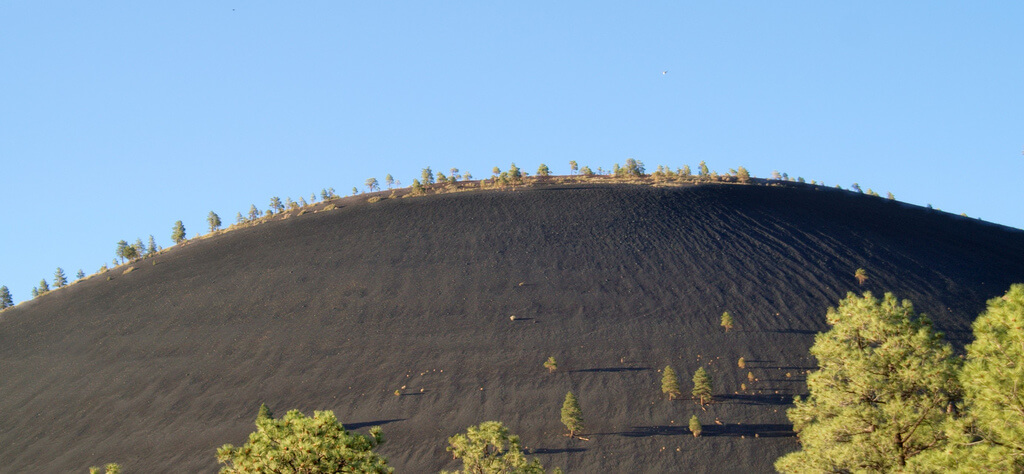
At the center of all of the sediment, stand the 1,000-foot tall cinder cone with the stunning Sunset Crater in the center. Spanning a mile and dipping 400 feet deep, it is incredibly breathtaking to think about the processes that formed this humongous hole. When envisioning the violent events that created the crater, though, the last vista one might consider is a colorful sunset, especially given that ash from the eruption had likely obscured the sun for much of the century.
How Did Sunset Crater Get Its Name?
When finally, this volcano was nearly done erupting, one final burst of vapors caused a chemical reaction with the upper cinders near the crater. As a result, instead of the dull-colored ash that can still be seen in other places, the summit of the cone is vibrant with pinks, reds, whites, and yellows — the colors of the sunset.
5) Not Everyone Refers to This Crater by the Same Name
The Hopi Indians refer to Sunset Crater as Palatsmo, meaning “the red hill.” In their traditions, they speak of “u’wing pangk yama,” or “when the fire came,” causing their ancestors to flee the area. Their traditions explain that the volcanic eruptions were brought on by the spirit Qa’na, the bringer of corn. He caused the eruptions because he was displeased with the immoral lives that many of the Sinaguans were living.
Archaeologists believe that since they found only empty settlements and no bodies buried beneath the volcanic ash, the Sinagua people were smart enough to heed the initial signs of impending doom for the area. Other archaeologists have discovered evidence that the Sinagua people had attempted to make sacrifices of corn to the volcano. Most likely in hopes of ending the eruptions.
6) Is the Sunset Crater Volcano Active or Dormant?
There has been no volcanic activity from this location in over 800 years. But, that doesn’t mean that the destruction of this 100-year eruption isn’t still very obvious.
Only recently has nature been able to claim enough of a foothold for any vegetation to begin regrowing. Instead, cinder fields and lava flows still make up most of the landscape here. The National Park Service has been keeping an eye on this area since 1930 when Herbert Hoover named it a National Monument. This came as a result of a movie company’s plans to blow up the volcano to film a simulated eruption.
Before 1973, you could hike to the summit of the crater, but tourist traffic resulted in visible wear in the form of a deep rut up the side of the volcano. There is also an ice cave at the foot of the cinder cone. It is no longer accessible due to safety reasons. A present-day visitor can enjoy a loop trail around the base of the volcano and an informative visitor’s center.

Here are 10 Things People from Oregon Do That Seem Insane To Everyone Else

15 Expressions You’ll Only Understand if You’re From South Carolina

Here are 10 Things People from New Jersey Do That Seem Insane To Everyone Else

Here are 10 Things People from Kentucky Do That Seem Insane To Everyone Else

Here are 10 Things People from Texas Do That Seem Insane To Everyone Else

Check Out This Salt Cave in New Mexico That is Said to Melt All Your Stresses Away

10 Photos Only People from Arizona Will Understand

Here are the 10 Best Mexican Restaurants in New Mexico – Awesome Margaritas Included

This Arizona Park Lets You Drive Thru the Beautiful Ponderosa Pine Forest, and See Animals in Their Natural Habitat