Arizona
This Hike in Arizona is Said To Be One of the Most Dangerous in the World
If you’re a mountaineer, you’d understand that hiking isn’t just a simple outdoor activity. It’s also a way of life, and at times, a big risk. We already gave you awesome lists of beginner-friendly hikes, and pet-friendly trails. Now, let’s take it up a notch! Here’s what you should know about the Bright Angel Trail in Arizona a.k.a. one of the world’s most dangerous hikes. Is it something you should be afraid of? There’s only one way to find out.
About the Hike
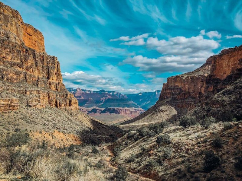
Source: Instagram
The Bright Angel Trail in Arizona is one of the most breathtaking hiking trails in the world. It is traveled by thousands of mountaineers each year because of the challenging terrain and majestic views. However, this trail in the Grand Canyon also made it to the list of the world’s most dangerous hikes. But why is that? How can something so heavenly-sounding be a threat to your life? Well, maybe that’s the irony in all this. You’ll probably be on your way to meet the bright angels up above if you don’t survive the hike.
If you decide to commit, you should always keep in mind the extreme weather condition as you prepare to be physically-ready for this big hike!
What Should You Expect in This Trail?
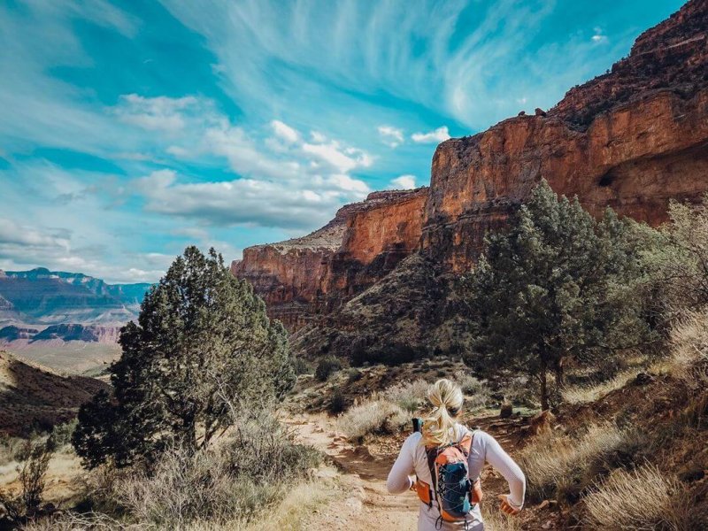
Source: Instagram
First, you should be prepared to trek from rim to river and back. It sounds quite a journey, especially because it’s what every Grand Canyon adventurer longs to notch. But here’s the catch. The canyon temps will routinely top 110°F in the summer and you’ll feel like you’re already in hell because of the scorching heat.
Second, you must be physically able to climb 4,380 vertical feet over 9.5 miles. Let’s say you’re a veteran in the Spartan Races, but this is a different challenge. Try not to be dead on your way to the top.
Third, let’s look at the statistics. There are too many rescues in the Bright Angel Trail that prompted the creation of the Preventative Search and Rescue or PSAR in 1997. This team is in charge of patrolling the trail, assessing all hikers, as well as dispensing water to those who need it and urging the unprepared hikers to seek safety.
The highest point of the Bright Angel Trail is at 6,860 feet. If one must compare it to the Colorado River, the elevation is only that of 2,480 feet. We already talked about how difficult it is to climb the trail during summer. It’s equally challenging during winter and early spring because the trail will be icy and dangerous. During these times, the visitors are required to wear crampons while exploring.
What Does Death Feel Like on the Bright Angel Trail?
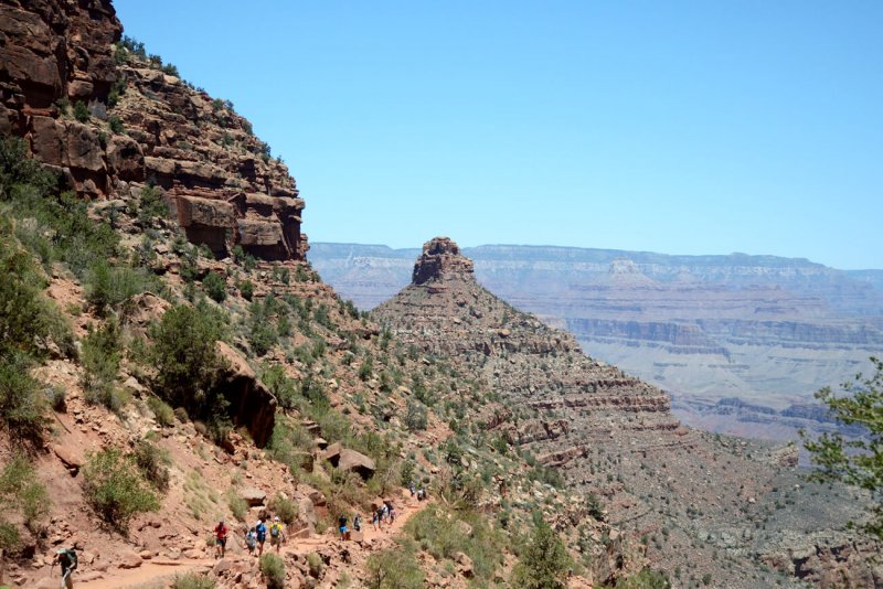
Source: Barefoot Theory
This probably sounds like a horrific question, but it pays to get a visual so you’d think twice, thrice, or even a hundred times before coming here.
If you die on the Bright Angel Trail under the mercy of the hot sun, your brain cells will burst like tiny egg sacks. Not only that, the thick, salty fluid of these egg sacks will spill in thousands of deadly hemorrhages. Back in 2005, a 28-year-old hiker named Avik Chakravarty experienced scorching thirst, painful cramps, and hallucinations before he died during the same year in July. He climbed up in the midafternoon heat and overestimated his calculations.
What You Should Know
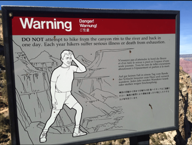
Source: Reddit
The “death zone” of the Bright Angel Trail is between the river and Indian Gardens, which is about halfway up. Many hikers have this impression that going down is easy that they forget the climb is extremely torturous. Michael Ghiglieri, a Colorado River guide, says that the dark grey schist found at lower elevations absorbs and radiates heat just like a cast-iron frying pan. So when you look at the thermometers that read 110°F from the shade at Phantom Ranch, you’ll find yourself enduring up to 130°F ground temps when you’re out on the trail.
Don’t commit the mistake of many previous hikers of hurrying along. You can’t escape the hot inferno by running or climbing up because that will only exacerbate heat illness. Instead, you should rest for 15 minutes of every hour you climb.
Day hikers may want to consider the following:
- 1.5-mile Resthouse. The hiking time for this is 2 to 4 hours, out and back.
- 3-mile Resthouse. Allot 4 to 6 hours hiking time out and back for this hiking activity.
Here Are Some Bright Angel Trail Survival Tips That May Come in Handy:
Source: Instagram
- You should set off as early as 5 am to avoid the unmerciful heat. If you want, you can also delay your return until evening. Just finish your hike by headlamp.
- Remember to cool off in the creek. Don’t skip that part. You’ll find that as your clothes dry, the air can flow more freely through your body, and it will help keep you cool.
- Carry lots of water if you plan to hike the Bright Angel Trail. Prepare at least five to six liters of water to be safe. That should be enough for a round trip.
- Pace yourself on the ascent. Non-stop climbing isn’t ideal, unless of course if your plan is to drop dead.
- Equip yourself with a good gear. Make sure your pair of hiking shoes are reliable because this is one of the most dangerous hikes in the world!
- Pack some food, trail snacks, electrolyte replacement drink, and energy bars.
Additional Note: The Bright Angel Trail will ascend 4,400 feet over 9.5 miles. You will be climbing from 2,400 feet to 6,800 feet, and the altitude will most definitely affect hikers who are not acclimated. Hike at your own risk, and remember to practice caution throughout the whole journey.
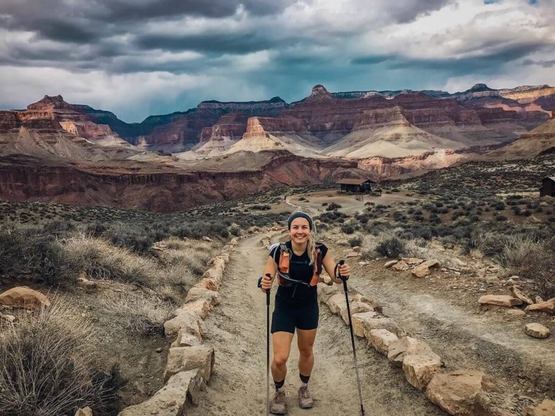
Take A Look At These Photo Inspirations at the Bright Angel Trail
Flaunt your flawless body and active moves with the beautiful rock backdrop!
Source: Instagram
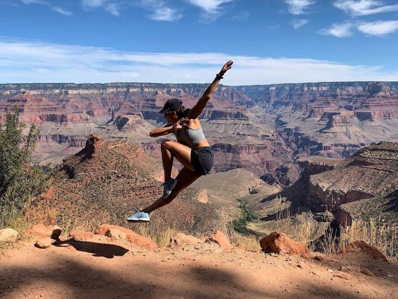
Or you can also let people know how to live life on edge… literally!
Source: Instagram
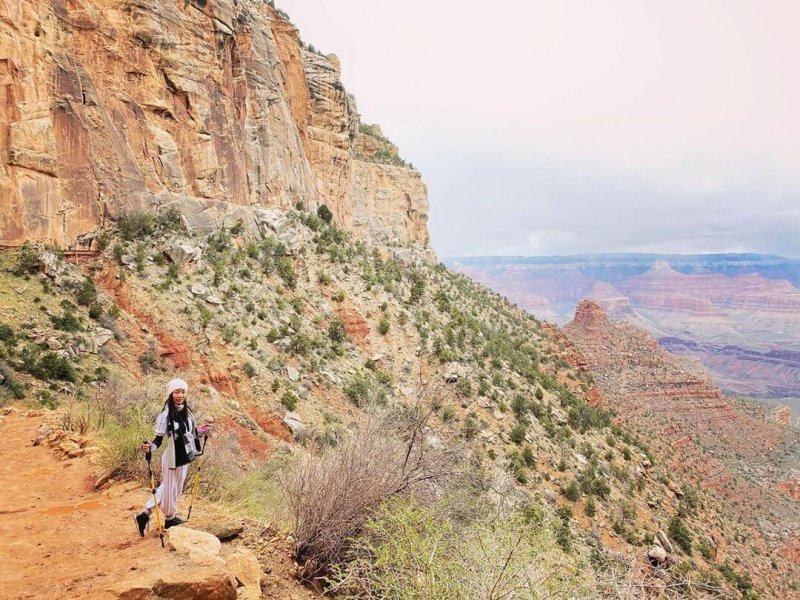
If you prefer a traditional photo, how about a “I’ll lead the way” pose?
Source: Instagram
General Information: Bright Angel Trail
Difficulty Level: Strenuous/Difficult
Distance: 15.3 km out and back
Elevation Change: 6,800 feet or 2,072 m
Location: Grand Canyon National Park (65 miles northwest of Flagstaff, Arizona)
Notes:
- No pets are allowed on this trail.
- You can camp below the rim, but it requires backcountry camping permits and additional fees. For more details, you may check out their website.
Website: https://www.nps.gov/grca/index.htm
After this strenuous hike, don’t you think spending the day in a natural water park sounds like the next great plan?

15 Expressions You’ll Only Understand if You’re From New York

10 Things You Should Never Ever Say to Someone from Oregon

10 Things You Should Never Ever Say to Someone from Texas

10 Things You Should Never Say to Someone from Florida

Here are 10 Things People from Arizona Find Highly Offensive

Check Out This Salt Cave in New Mexico That is Said to Melt All Your Stresses Away

This Arizona Park Lets You Drive Thru the Beautiful Ponderosa Pine Forest, and See Animals in Their Natural Habitat

Here are 22 Slang Terms You’ll Only Understand if you’re from Illinois

Here are 20 Slang Terms You’ll Only Understand if you’re from Indiana

10 Reasons Why You Should Never Ever Consider Moving to Alabama

 New Mexico6 days ago
Check Out these Hand-Carved Sand Caves Made 100% By Hand Found Only in New Mexico

 New Mexico3 days ago
Check Out this Abandoned Health Resort in New Mexico that has an Eerie History

 Arizona3 days ago
This Alluring Glass Atrium in Sedona Is the Perfect Spot for Couples Who Seek Luxury and Nature

 South Carolina6 days ago
15 Expressions You’ll Only Understand if You’re From South Carolina

 Ohio3 days ago
Here are 10 Things People from Ohio Do That Seem Insane To Everyone Else

 Pennsylvania5 days ago
15 Expressions You’ll Only Understand if You’re From Pennsylvania

 Florida6 days ago
Here are 10 Things People from Florida Do That Seem Insane To Everyone Else

 New Jersey6 days ago
Here are 10 Things People from New Jersey Do That Seem Insane To Everyone Else